Many of the ski areas are already closed. Copper closes on Mother’s Day, Breck and A-Basin still haven’t committed to a closing date. The weather is warmer and the snow is heavier. It’s spring in Summit County and the spring fever is hitting me hard this year.
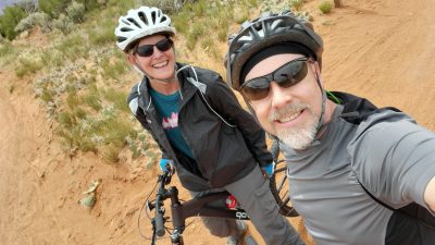
We headed out to Moab for a week and got a taste of 75 degree days. 4 wheeling and mountain biking were on the agenda. Now I can’t wait to tackle the trails and do some mountain biking in Summit County. If you know me, when I say tackle, it very well could be falling off my bike and actually tackling the trail! Ha! I am planning for some more seat time this summer and an improvement in my riding ability.
Trails open May 21st
Regardless of how anxious I am, I have to wait until May 21st when the Summit County forest service trails open to summer biking. Even after that, trail conditions may not allow for biking. Riding in the mud creates ruts, damages the trails and is not recommended. There are some trails, like Tenderfoot, that get good sun and can be dry even if May continues to snow and rain. Until then, I am getting my bike legs back by riding on open trails and some dirt roads, working those needed muscles that have been dormant too long.
Mountain biking etiquette
Because I am a novice on the bike, I always need to refresh my memory with trail etiquette. Mountain bikes always yield to hikers and horses. Downhill bikers should yield to uphill bikers. Of course, the standard wilderness rules still apply. Stay on the trails, don’t go off trail to go around puddles or take shortcuts. Know where you are and what to do in an emergency. Don’t litter.
E-bikes
E-bikes are becoming more and more common on the trails. If you have an e-bike, keep in mind that they are classified as a motorized vehicle and not allowed on all bike trails. E-bikes are only allowed on those trails designated for motorized, licensed or unlicensed vehicles.
Mountain biking trails
There are a lot of maps out there to help finding and navigating trails. Summit County Open Space has some trail maps, along with the local towns, the Forest Service and CoTrex. We have been using Gaia a mapping app and this summer I will be using MTB Project more. I hear that is a pretty good app. I am counting the days until the trails are dry and I can start mountain biking in Summit County again.


Leave a Reply